cosmos.wikisort.org - Spacecraft
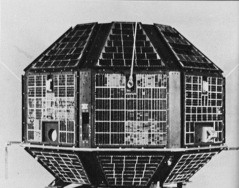
Cartosat-2B is an Earth observation satellite in a Sun-synchronous orbit and the fourth of the Cartosat series of satellites. The satellite is the seventeenth satellite in the Indian Remote Sensing (IRS) satellite series to be built by the Indian Space Research Organisation (ISRO).[5]
| Names | CartoSat-2B |
|---|---|
| Mission type | Earth observation |
| Operator | NTRO |
| COSPAR ID | 2010-035A |
| SATCAT no. | 36795 |
| Website | https://www.isro.gov.in/ |
| Mission duration | 5 years (planned) 12 years, 2 months and 26 days (in progress) |
| Spacecraft properties | |
| Spacecraft | CartoSat-2B |
| Bus | IRS-2[1] |
| Manufacturer | ISRO |
| Launch mass | 694 kg (1,530 lb) [2][3] |
| Dry mass | 630 kg (1,390 lb) |
| Power | 930 watts |
| Start of mission | |
| Launch date | 12 July 2010, 03:52 UTC |
| Rocket | Polar Satellite Launch Vehicle, (PSLV-C15) |
| Launch site | Satish Dhawan Space Centre, First Launch Pad (FLP) |
| Contractor | Indian Space Research Organisation |
| Entered service | October 2010 |
| Orbital parameters | |
| Reference system | Geocentric orbit[4] |
| Regime | Sun-synchronous orbit |
| Perigee altitude | 623 km (387 mi) |
| Apogee altitude | 644 km (400 mi) |
| Inclination | 97.92° |
| Period | 94.72 minutes |
| Instruments | |
| Panchromatic Camera (PAN) | |
Earth observation satellites series | |
Instrument
The satellite carries a panchromatic camera (PAN) capable of taking black-and-white pictures in the visible region of electromagnetic spectrum. The highly agile Cartosat-2B can be steered up to 26° along as well as across the direction of its movement to facilitate imaging of any area more frequently. Very-high-resolution land imagery.[3]
Launch
It was launched along with the 116 kg Algerian satellite Alsat-2A, one nanosatellite each from Canada (AISSat-1) and Switzerland (TIsat-1), and STUDSAT-1, an Indian picosatellite, on 12 July 2010, at 03:52 UTC[6] in a Polar Satellite Launch Vehicle (PSLV-C15) launch vehicle from the spaceport at Sriharikota.[7][8]
See also
- List of Indian satellites
References
- "Cartosat 2, 2A, 2B, 2C, 2D, 2E, 2F". Gunter's Space Page. 7 July 2020. Retrieved 10 May 2021.
- "Cartosat-2B". ISRO. 12 July 2010. Retrieved 14 May 2021.
- "Satellite: CartoSat-2B". World Meteorological Organization (WMO). Retrieved 14 May 2021.
- "CARTOSAT 2B". Heavens Above. Retrieved 14 May 2021.
- "Cartosat-2B". ISRO. Archived from the original on 21 January 2013. Retrieved 13 May 2021.
- "Display: Cartosat-2B 2010-035A". NASA. 27 April 2021. Retrieved 13 May 2021.
 This article incorporates text from this source, which is in the public domain.
 - "PSLV-C15 / Cartosat-2B Mission Brochure" (PDF). ISRO. 2010. Retrieved 14 May 2021.
- "ISRO to launch more satellites this year". The Times of India. 12 July 2010. Retrieved 12 July 2010.
Indian spacecraft | ||||||||||||
|---|---|---|---|---|---|---|---|---|---|---|---|---|
| ||||||||||||
| Satellites |
|  | ||||||||||
| Space probes |
| |||||||||||
| Human spaceflight |
| |||||||||||
| ||||||||||||
| ||
| Organisations |
| |
| Programmes |
| |
| Satellites | ||
| Space observatories |
| |
| Lunar and planetary spacecraft |
| |
| Crewed spacecraft |
| |
| Rockets |
| |
| Facilities |
| |
| Legislation and policy |
| |
| Private companies |
| |
| Related |
| |
| ||
На других языках
[de] Cartosat-2B
Cartosat-2B ist ein indischer Erdbeobachtungssatellit aus der Indian-Remote-Sensing-Reihe.- [en] Cartosat-2B
Другой контент может иметь иную лицензию. Перед использованием материалов сайта WikiSort.org внимательно изучите правила лицензирования конкретных элементов наполнения сайта.
WikiSort.org - проект по пересортировке и дополнению контента Википедии